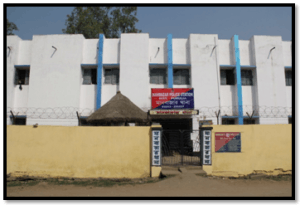
Manbazar PS is located at 23° 3'38.94"N and 86°39'35.85"E and 45 Km East from District HQ. Manbazar Police Station has a jurisdiction over an area of 411.11 sq KM having population 1,53,985, out of which 78,335 were males and 75,650 were females with 07 GP . This Police Station is under Purulia Sadar West Sub-Division and sharing border with Boro, Barabazar, Kenda, Puncha PSs of this district. The PS has one Block and maximum people livelihood is very poor.
Neturia PS is located at 23°39'42.10"N and 86°49'29.63"E and 70 Km North from District HQ. Neturia Police Station has a jurisdiction over an area of 203.65 Sq. KM having population 1,01,922 out of which 52,660 were males and 49,262 were females with 07 GP. This Police Station is under Purulia Sadar West Sub-Division and sharing border with Burdwan District Raghunathpur, Santuri PSs of this district. The PS has one Block and maximum people livelihood is very poor. Main earning of the area is cultivation.
Bandwan P.S is located at 22°52'38.75" N and 86°30'16.90" E and 65 Km South from District HQ. Bandwan Police Station has a jurisdiction over an area of 367.08 Sq. Km. Population is 95,002 out of which 47,818 male and 47,184 female. Sub-Division: Purulia Sadar (East) Number of Gram Panchayats: 08. Inter-State Borders: 52.44 Kms. with (a) Galudih PS of East Singhbhum district, (b) Patamda PS of East Singhbhum district and (c) Kamalpur PS of East Singhbhum district all of Jharkhand State . Inter-District Borders: With Boro PS of Purulia district and Belpahari PS of Paschim Medinipur District. Number of Blocks Covered: 01. Primary Livelihood: Cultivation. Economic Status: Backward.
Balarampur P.S is located at 23° 6'2.97" N and 86°13'29.39" E and 32 Km South West from District HQ. Balarampur Police Station has a jurisdiction over an area of 299.5 Sq. Km. Population is 1,39,744 out of which 71,899 male and 67,845 female. Sub-Division: Purulia Sadar (West) Number of Gram Panchayats: 07 . Inter-State Borders: 12.39 Kms. with (a) Nimdih PS of Saraikella Kharsawan District, Jharkhand. Inter-District Borders: With Bagmundi, Barabazar and Arsha PSs of Purulia District. Number of Blocks Covered: 01. Primary Livelihood: Cultivation. Economic Status: Backward
Kashipur PS is located at 23°26'9.06"N and 86°40'16.43"E and 36 Km East from District HQ. Kashipur Police Station has a jurisdiction over an area of 801.88 sq Km having population 1,99,932, out of which 1,01,710 were males and 98,222 were females with 13 GP. This Police Station is under Purulia Sadar Sub-Division and sharing border with Bankura District with 51 Km and Hura, Para, Raghunathpur, Santuri PSs of this district. The PS has one Block and maximum people livelihood is very poor. Main earning of the area is cultivation.
Puncha PS is located at 23° 9'33.61"N and 86°39'3.13"E and 43 Km East from District HQ. Puncha Police Station has a jurisdiction over an area of 330.11 Sq KM having population 1,23,768 out of which 62,695 were males and 61,073 were females with 08 GP. This Police Station is under Purulia Sadar West Sub-Division and sharing border with Manbazar, Kenda, Hura PSs of this district. The PS has one Block and maximum people livelihood is very poor.
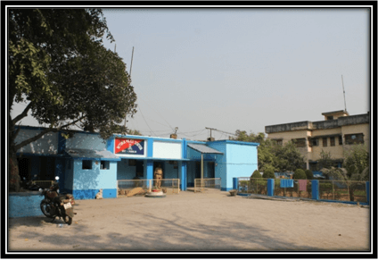
Santaldih PS is located at 23°35'0.59"N and 86°28'15.54"E and 42 Km East from District HQ. Santaldih Police Station has a jurisdiction over an area of 98.34 Sq. Km having population 54,667 out of which 28,448 male and 26,219 female with 06 GP . This Police Station is under Purulia Sadar West Sub-Division and sharing border with Para, Raghunathpur PSs of this district. The general scenario is undulating land with scattered hills. It is located south of Damodar River. To the north of the river is Sindri in Dhanbad district of Jharkhand. Main earning of the area is cultivation.
Joypur PS is located at 23°25'4.16" N and 86° 8'30.21" E and 28 Km. North West from District HQ. Joypur Police Station has a jurisdiction over an area of 230.50 Sq. Km. Population is 1,33,240 out of which 68,891 male and 64,349 female. Sub-Division: Purulia Sadar (West). Number of Gram Panchayats: 07. Inter-State Borders: 52.00 Kms. with (a) Joridih PS of Bokaro District, (b)Balidih PS of Bokaro District and (c) Pindrajora PS of Bokaro District. all of Jharkhand State . Inter-District Borders: With Kotshila, Arsha and Purulia (M) PSs of Purulia district. Number of Blocks Covered: 01. Primary Livelihood: Cultivation. Economic Status: Backward.
Jhalda PS is located at 23°21'55.25" N and 85°58'37.09" E and 48 Km. West from District HQ. Jhalda Police Station has a jurisdiction over an area of 290.00 Sq. Km. Population is 1,57,064 out of which 80,380 male and 76,684 female. Sub-Division: Purulia Sadar (West). Number of Gram Panchayats: 10. Inter-State Borders: 48.7 Km with (a)Silli PS of Ranchi District and (b)Kashmar & Joridih PSs of Bokaro district, (c) Gola, PS of Ramgarh district. all of Jharkhand State. Inter-District Borders: With Kotshila and Bagmundi PSs of Purulia district. Number of Blocks Covered: 01.Primary Livelihood: Cultivation. Economic Status: Backward.
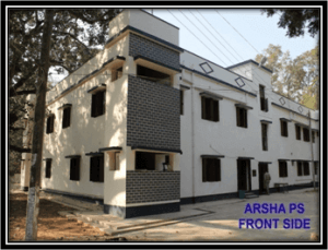
Arsha PS is located at 23°26′00″N and 86°08′00″ E and 32 Km East from District HQ. Arsha Police Station has a jurisdiction over an area of 187.5 Sq. Km. Population is 1,54,542 out of which 78,606 male and 75,936 female. Sub-Division: Purulia Sadar (West) Number of Gram Panchayats: 08 Inter-State Borders: No border with other State. Inter-District Borders: With Joypur, Kotshila, Bagmundi, Balarampur, Barabazar and Purulia (M) PSs of Purulia district. Number of Blocks Covered: 01 Primary Livelihood: Cultivation Economic Status: Backward
Description

 Skip to content